The city of Ottawa looks very beautiful and colorful. All tourists who visit this city are usually delighted with it. Ottawa is striking in its beauty, variety and combination of different styles of architecture. But in addition to its beauty, Ottawa is a modern city rapidly built and developed in the early 20th century. Therefore, the city government of Ottawa faced the question of creating a city metro, which would greatly facilitate the life and mobility of citizens back in 1915. Learn more at ottawa-future.com.
Metro, a crucial part of growing cities
The government of Ottawa has taken many steps toward building a city metro during a period of rapid urban growth. After all, such urban transport is a crucial part of a fast-growing city. For example, in one of the most developed Canadian cities, Montreal, metro construction was discussed as early as 1910. But it wasn’t possible to build such a complex transportation infrastructure fast. It took almost 50 years to develop a thorough project plan and complete the construction itself. The situation was similar in the Canadian city of Toronto. The first plan for metro construction appeared there a year earlier than in Montreal, in 1909, but was implemented only in 1954.
The metro construction wasn’t fast, even in Europe. For example, there was talk of a Paris Metro as early as 1854, but the new transport infrastructure for Paris wasn’t built until the early 20th century.
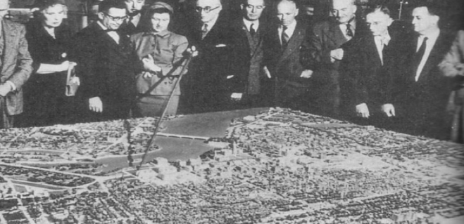
Metro construction planning in Ottawa
The first plan for a new transportation infrastructure for Ottawa was presented in 1915. The metro was supposed to relieve the downtown from massive traffic jams.
It was the congestion that was mentioned in a report to Ottawa officials in 1915. It noted that Sparks Street, as well as other nearby streets, including Bank and Elgin Streets, were very congested.
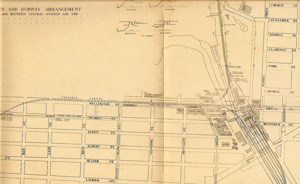
In the early 20th century, the streetcar was running through the streets of Ottawa. Its cars were planned to be placed in the new metro between the two Bronson and Rideau Streets. Then, from this point, the plan was to dig a tunnel for the future metro line that would lead to both Bank Street and Elgin Street. In addition, the metro was to surface through portals located at the intersection of Rideau Street and Sussex Street and the end of Laurier Avenue to Bank and Elgin Streets.
Metro. Why was it needed?
In the early 20th century, congestion on city streets was almost at its peak. Therefore, the Ottawa government considered all possible options to improve the road infrastructure to facilitate traffic flows through the city’s streets. One such solution was to take the streetcar underground. The proposed plan could have reduced the amount of traffic congestion in the downtown many times over.
The unusual metro
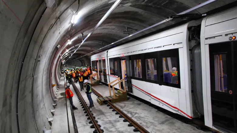
The construction of the Ottawa Metro wasn’t intended to change the road infrastructure on a large scale. In other words, the Ottawa Metro would not have been the same as it is in other metropolises. It would have been more like a streetcar line, partially taken underground. Implementing a plan to build a streetcar metro in early 20th century Ottawa was the best way to relieve the downtown, thus separating streetcar traffic from other surface transportation.
Why was the plan to build a streetcar metro not implemented?
Unfortunately, the authorities in Ottawa failed to implement the plan to build a metro and relieve traffic congestion on the streets since Canada was embroiled in a war in the early 20th century. Accordingly, funds were allocated for quite other needs. Therefore, the plan to build the metro had to be postponed.
Besides the war, tragedy struck Ottawa in 1916. During a council meeting, a fire broke out at Parliament Hill. The Parliament building was completely destroyed. The building wasn’t just a place of government but a veritable architectural creation and the strength of the entire nation. So the city government invested money to rebuild the historic building, while the metro construction had to be canceled again.
Reviving the idea of building a metro
More than 50 years passed since the Parliament Hill fire before the government of Ottawa started working on a plan to build a metro again.
The new design for the Ottawa Metro line preserved some elements of the original plan, but for the most part, the construction plan was entirely changed.
Within ten years, the population of Ottawa exceeded half a million. Population growth in the city has led to an increase in the number of cars on city roads. Once again, the issue of problematic traffic on city streets became acute. There was a lot of congestion and horrible traffic. So Hammer, an experienced consultant from Washington, D.C., was commissioned to develop a new plan to relieve downtown Ottawa.
Hammer Report
The Hammer Report envisioned a prominent redevelopment and expansion of the city of Ottawa. According to Hammer Report, new highways were to be built in addition to the metro construction. It also included the demolition of houses and the construction of new ones with height restrictions, the construction of new bridges and more.
What was supposed to be built?
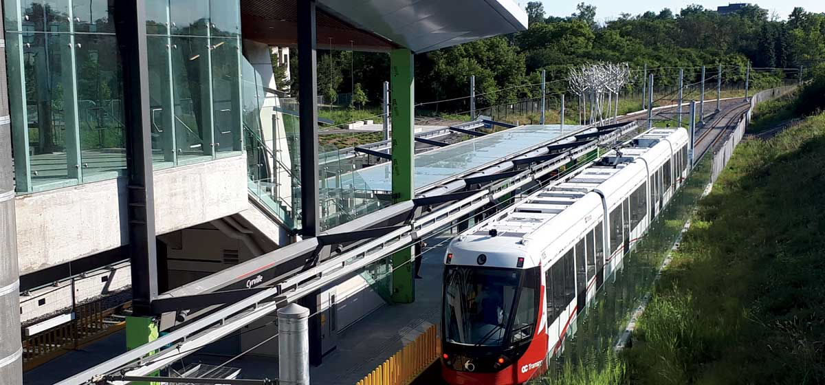
Under Hammer Report, the metro line was to be located between Lebreton Flats and Sandy Hill. The metro line was to go under Queen and Besserer Streets, extending to Vanier and Nepean as a surface metro line. A line of the Ottawa Meto was to stretch as far as St. Laurent Shopping Centre and Barrhaven suburb. There were to be a total of four stations on the line.
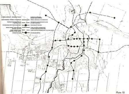
Another grandiose plan to rebuild the city’s infrastructure to relieve street congestion failed to come to fruition. The government could not implement the metro construction for over half a century. In the mid-20th century, Hammer Report wasn’t well received by the local population, as it involved the demolition of many houses and extensive construction of highways. Meanwhile, in the 1970s, the economic recession kicked in, so city and state funds were diverted to more urgent activities than the metro. But at the same time, the need to relieve the city center of traffic congestion did not disappear. Ottawa needed new transport and a new efficient road infrastructure.
A new phase of planning in 1976
Since the problem of jams and congestion in downtown Ottawa had not gone away over the years, in 1976, government officials began to analyze the situation from a different angle and consider various options for relieving the city. In particular, in 1976, along with the metro construction, they started discussing the light rapid transit construction. However, urban planners have concluded that the city has not yet been ready for rail rapid transit. Nevertheless, a new construction plan was developed and was fundamentally different from all the previous ones. This particular plan put the groundwork for the Transitway in place. It envisioned the construction of high capacity separated bus lines that could be converted to rail. The Transitway solution was essentially designed to prepare the city for rapid rail transit, building up ridership as the population grew until rail became justified to meet transportation needs. The routes, according to it, were different and the transport itself also differed from the most ordinary metro. However, this light rapid transit construction plan wasn’t implemented either.
The idea found its way into the late 1980s. It was proposed to separate the Transitway that runs through downtown with special bus tunnels. The idea was divided into two projects.
The first project involved raising the Transitway above Albert Street and Slater Street. The second project consisted of double tunnels that would have run underground under the same streets. However, the first one was promptly rejected by officials because it greatly disturbed the visibility of the Parliamentary precinct and other national monuments and landmarks from north to south. Accordingly, the second one was suggested for implementation.
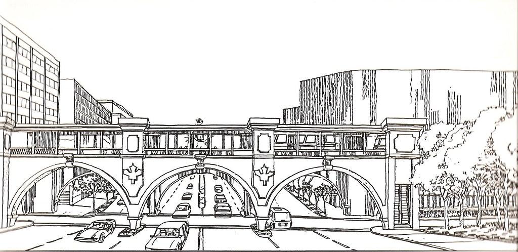
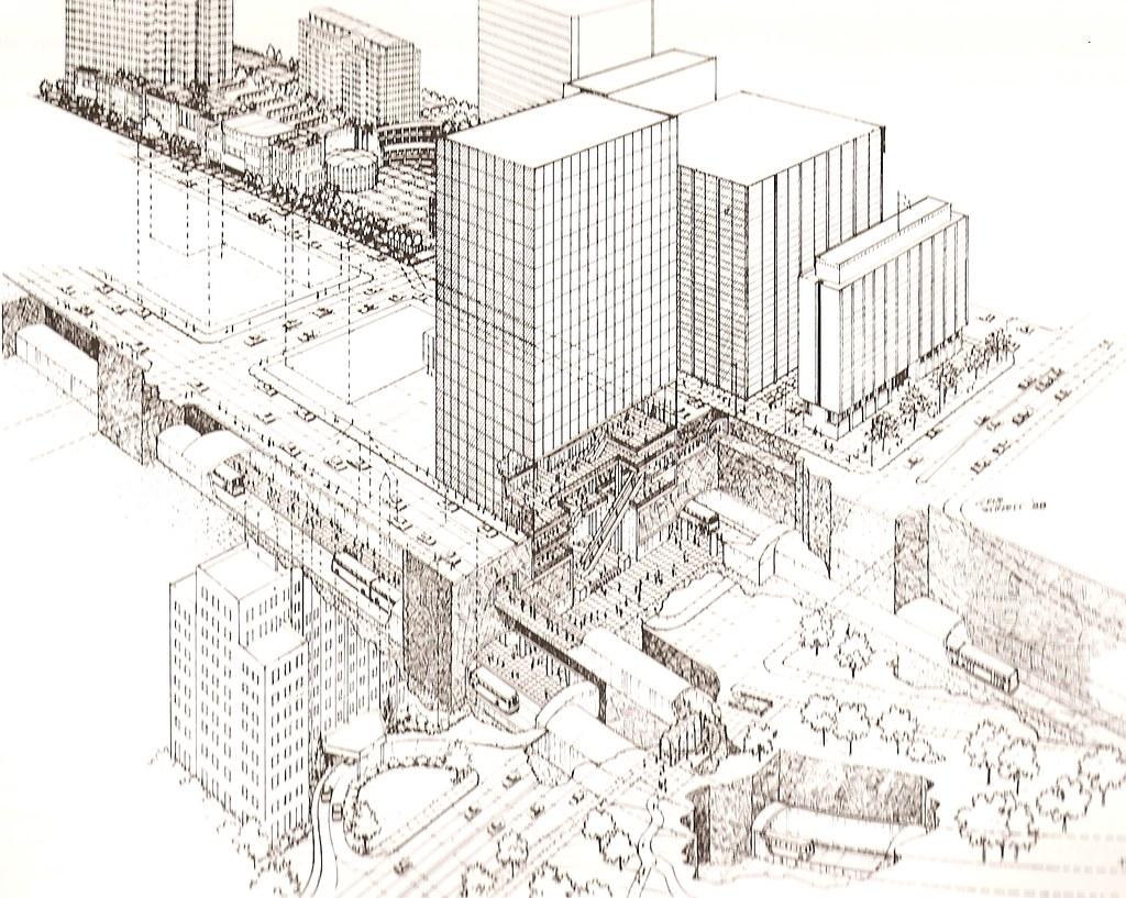
Another project was fated never to come to fruition. This time, political factors and funding prevented it.
It should be noted that any large city that has reached its peak in growth requires the construction of a new traffic interchange to transform and adapt the densely populated city completely.
Construction
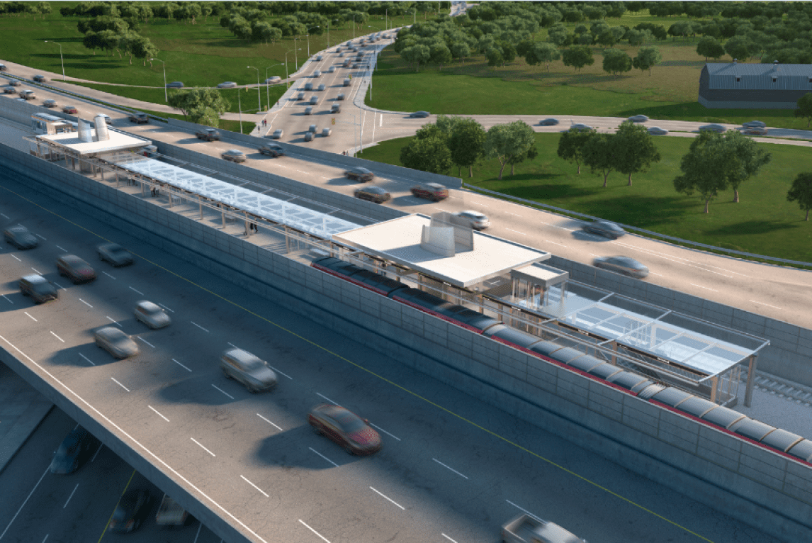
The Trillium line (the first O-Train line) of light rail transit came into being in 2001 as a test project designed to create an alternative to the Transitway, on which Ottawa had long relied. It had been almost a hundred years in the making. Moreover, further expansion of the light metro lines was also planned.
But problems arose again with the further expansion of the light metro line. The government rejected the light rail transit expansion project in 2006. This project was supposed to extend the lines from the northern districts to the southern ones and, accordingly, to the northeast and southwest. But at that time, the project was too costly for the Ottawa city government, which caused it to be rejected.
The light rail expansion was mentioned in 2014 when the next election of Ottawa’s mayor took place. Once again, two construction projects were put forward. The first was to use the existing city railroad lines, while the second was to build an entirely new line from the west to the east. It could completely replace the city buses and thus relieve the downtown area of traffic congestion.
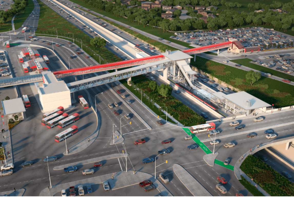
The second one was determined to be the best, so the government moved forward with it, although its building was significantly delayed. It wasn’t until 2018 that the new light rail line, Confederation Line, began operating in test mode and was officially opened in 2019.
Unlike the Trillium Line, the Confederation Line of the Ottawa light metro is double-tracked, which substantially increases its capacity.
The government didn’t stop there and continued construction for the light rail transit extension, including to Ottawa International Airport. It is expected to be completed in the autumn of 2023.